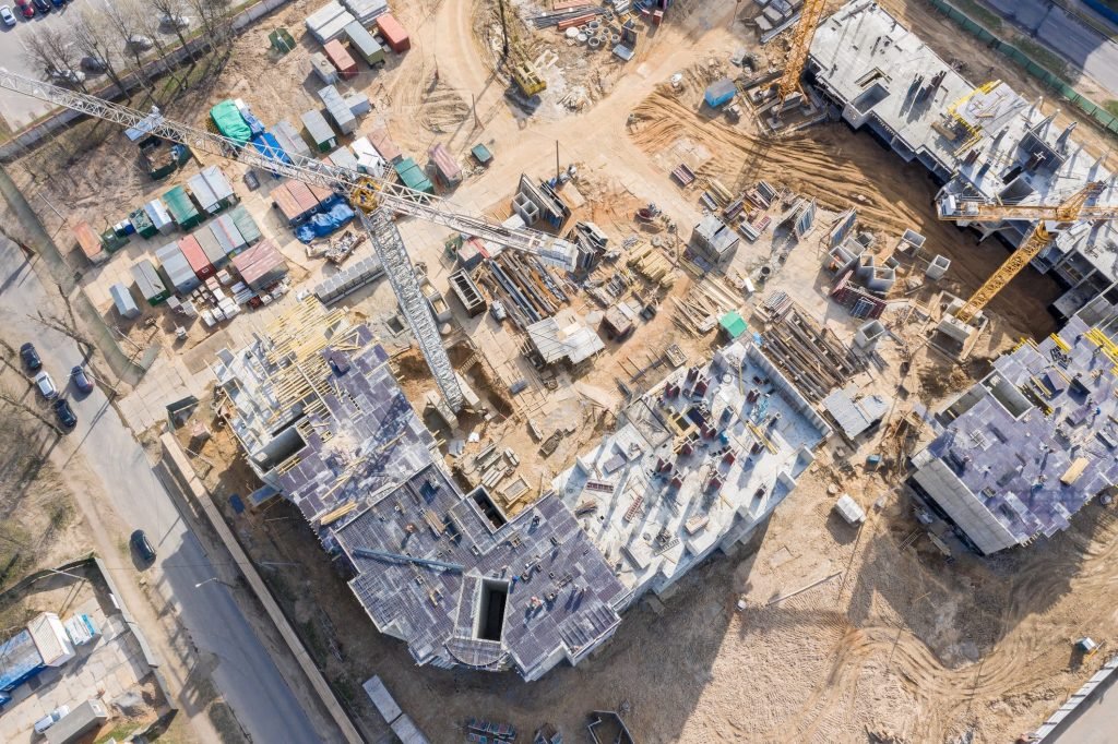
Stay ahead of schedule with high-resolution drone imagery that visually documents your project's progress from groundbreaking to completion. Our aerial reports make it easy to share updates, assess productivity, and catch issues early.
Stakeholder-Friendly Reports
Deliver clean, visual updates that clients, investors, and team members can easily understand.
Identify Delays Early
Spot bottlenecks or inactivity from above and act fast before small issues grow into major setbacks.
Field-to-Office Sync
Bridge the gap between the construction site and office with aerial overviews that drive smarter decisions.
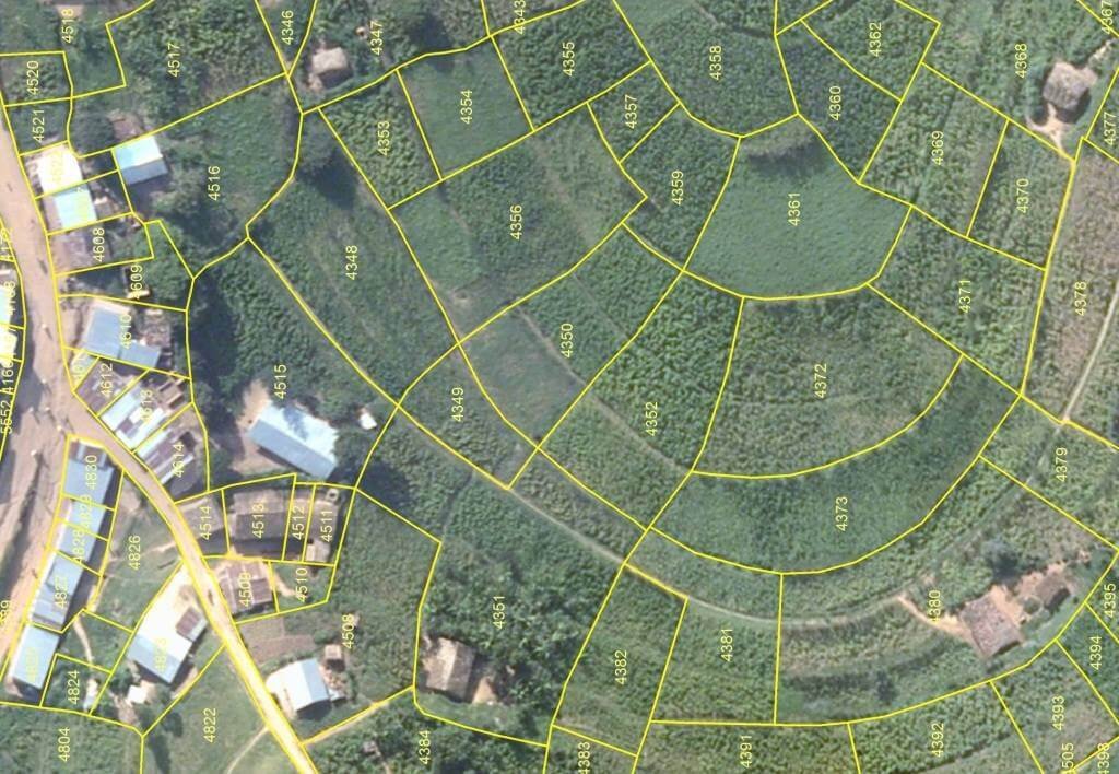
High-Accuracy Mapping for Smarter Decisions
Transform aerial imagery into powerful maps that support surveying, land planning, and engineering tasks. Our drone mapping delivers precision, speed, and clarity for complex projects.
Orthomosaic & Topographic Maps
Generate high-resolution, geo-referenced maps perfect for site planning and documentation.
Centimeter-Level Accuracy
We use advanced GPS and photogrammetry to ensure precision that rivals traditional surveys.
Construction & Planning Support
Use mapping to guide excavation, site layouts, and infrastructure positioning with confidence.
Ready to Elevate Your Project?
Take advantage of high-precision drone mapping, photogrammetry and inspection services tailored for commercial needs across Florida. Reliable, fast, and FAA-certified.
Drones allow you to inspect structures in minutes — no need for scaffolding, lifts or long downtime. Get high-res visuals and safety assessments even in hard-to-reach or hazardous areas.
Inspect Hard-to-Reach Areas
Bridges, towers, rooftops — drones capture what humans often can’t safely reach.
Maintenance Planning Made Easy
Spot trouble areas early and plan repairs before issues become costly failures.
Reduce Risk & Downtime
No climbing, no scaffolding — inspections are safer, faster and more efficient.